Introduction


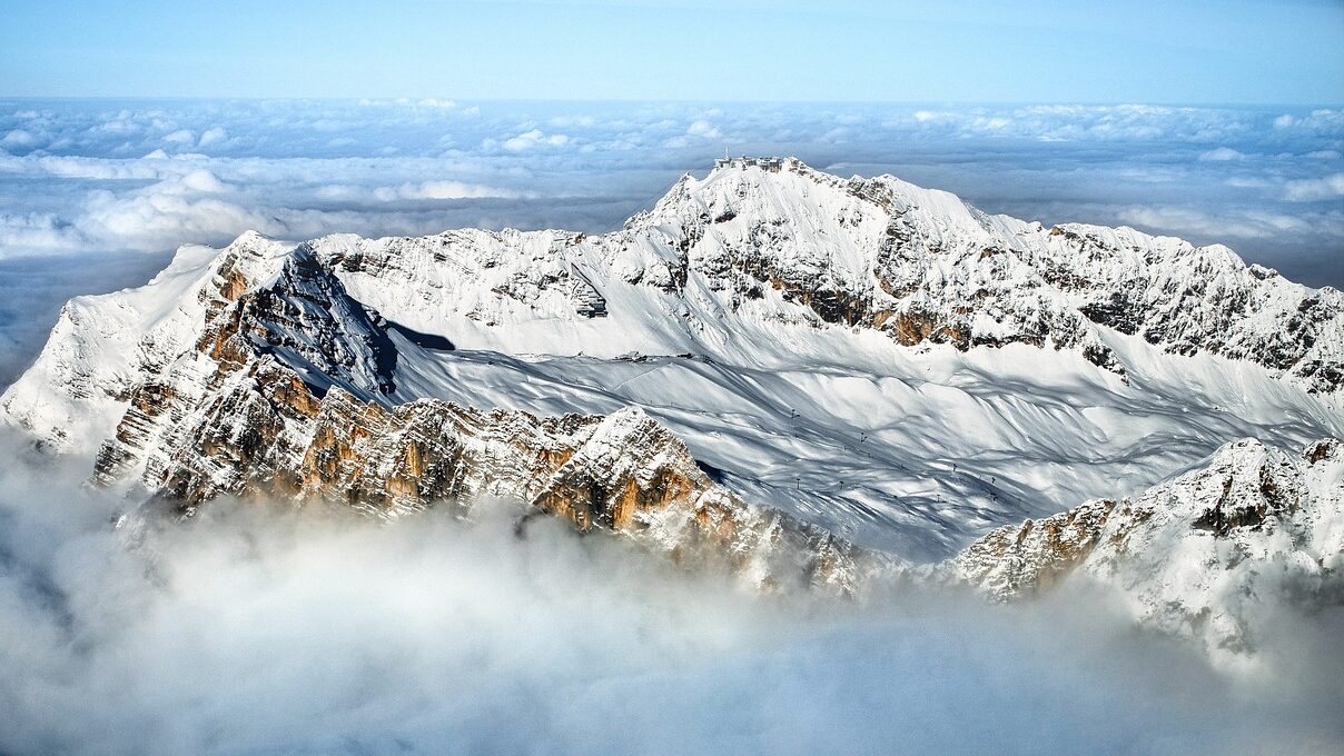
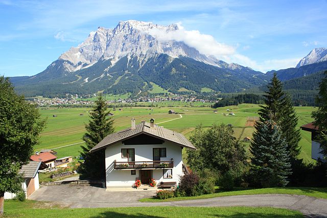
Zugspitze, standing at 2,962 meters, is Germany’s highest peak. Nestled in the Bavarian Alps near the border with Austria, Zugspitze offers a range of climbing routes suitable for varying skill levels. This guide provides all the essential information you need to plan and conquer this iconic summit, whether you’re an experienced mountaineer or a first-time climber.
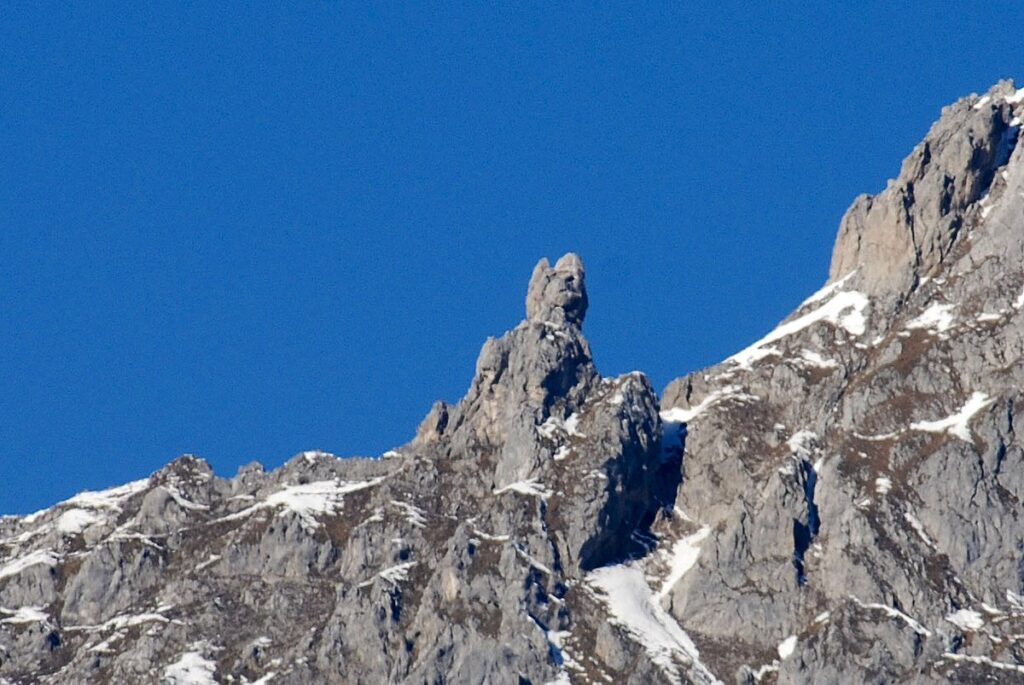
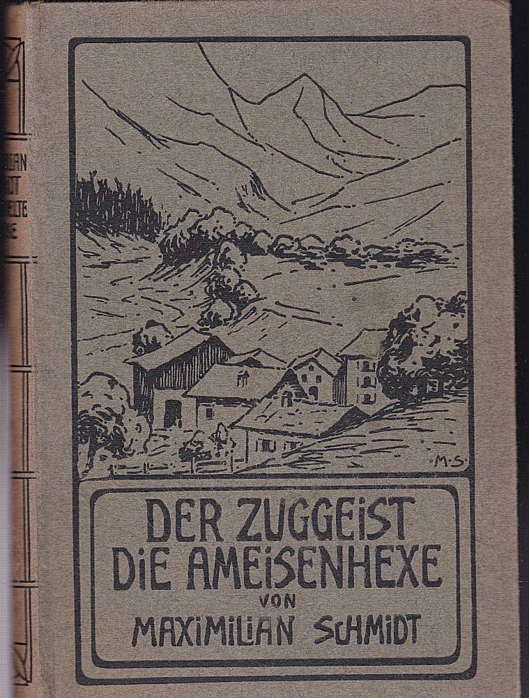
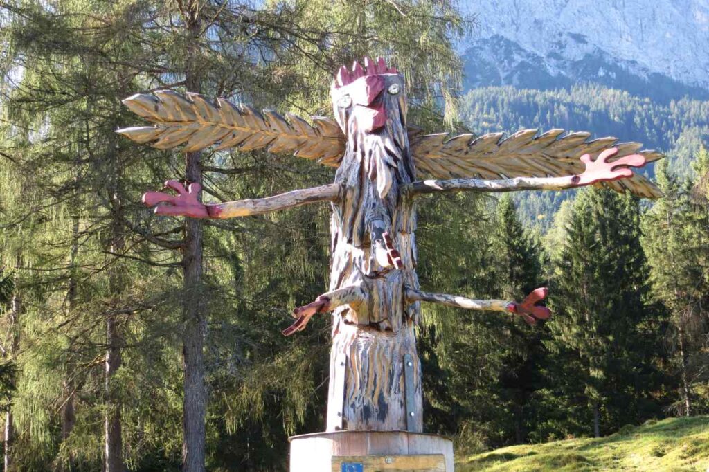
The Zugspitze is steeped in myths and legends that have been passed down through generations. One prominent legend speaks of the “Zuggeist,” a gigantic and malevolent vulture believed to have guarded the mountain, deterring intruders with its fierce presence. This fearsome creature is said to have inspired the mountain’s name. However, historical records suggest that the name “Zugspitze” actually derives from the German word “Zug,” referring to the paths or “trails” of snow avalanches that descend the mountain’s steep northern faces.
While the Zugspitze itself is primarily associated with the legend of the Zuggeist, the broader Bavarian and Tyrolean regions are abundant with folklore. For instance, the tale of Frau Hitt, a giant queen turned to stone due to her avarice, is linked to a prominent rock formation near Innsbruck. Such stories reflect the rich tapestry of myths that permeate the Alpine regions.

Best Time to Climb
The ideal time to climb Zugspitze is from late June to early September. During these months, the weather is more stable, and the trails are generally clear of snow, making conditions safer for climbers. Avoid climbing during winter unless you are an experienced mountaineer equipped for harsh alpine conditions.
Getting to Zugspitze from Berlin
- By Train:
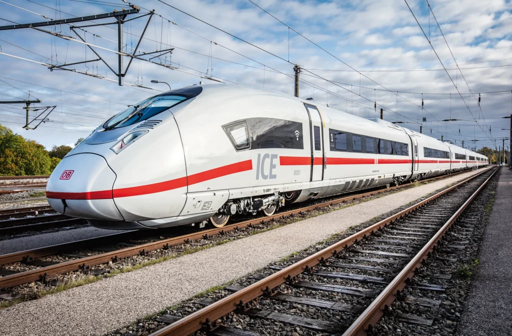
- Start from Berlin Hauptbahnhof (Central Station) and take an ICE (InterCity Express) train to Munich Hauptbahnhof. This journey covers approximately 600 km (373 miles) and takes 4-5 hours.
- From Munich, switch to a regional train heading to Garmisch-Partenkirchen, which is about 80 km (50 miles) away and takes 1.5 hours.
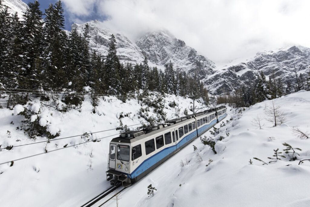
- At Garmisch-Partenkirchen station, catch a cogwheel train (Zugspitzbahn) or bus to the base of Zugspitze in the village of Grainau (approximately 10 km or 6 miles, 20 minutes).
- If using the alternative Höllental route, travel to Hammersbach: from Berlin, take a train to Garmisch-Partenkirchen, then transfer to a local train or bus to Hammersbach (approx. 7–8 hours total).
- Booking: You can purchase tickets for the ICE train and regional trains from Berlin Hauptbahnhof through Deutsche Bahn’s official website. Tickets for the Zugspitzbahn cogwheel train from Garmisch-Partenkirchen to Grainau can be purchased online.
- By Car:
- Drive from Berlin via the A9 motorway to Munich (approximately 600 km or 373 miles, about 6 hours) and then take the A95 motorway south to Garmisch-Partenkirchen (about 90 km or 56 miles, approximately 1.5 hours). From there, follow signs to Grainau and the Zugspitze base (10 km or 6 miles, 20 minutes). The total drive is approximately 700 km (435 miles) and takes 8 hours.
- By Plane:
- Fly from Berlin Brandenburg Airport (BER) to Munich International Airport (MUC), covering a distance of about 500 km (311 miles). From the airport, take a train to Garmisch-Partenkirchen as described above.
Choosing Your Route
Zugspitze offers multiple routes to the summit, ranging from challenging climbs to more relaxed options utilizing cable cars.
- The Reintal Route (Moderate Difficulty):
- Distance: ~42 km (26 miles) round trip.
- Duration: 16-20 hours round trip.
- Starting Point: Garmisch-Partenkirchen.
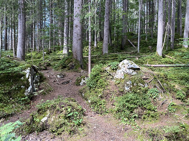
- Overview: This is the longest and least technical route, making it suitable for beginners with good endurance. The trail follows the Partnach Gorge, traverses the Reintal Valley, and ascends via the Knorrhütte (a mountain hut) before reaching the summit.
- Water Sources: There are several opportunities to refill water at huts like Partnachalm and Knorrhütte. Natural streams along the trail can also be used, but ensure water is filtered or treated.
- Guide Needed? No, unless you are unfamiliar with long-distance hikes or navigation. This route is a straightforward and well-marked hiking trail, with minimal technical challenges. However, it’s very long, so a guide may be helpful for pacing or first-time hikers.
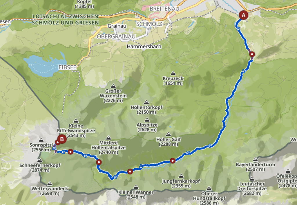
- The Höllental Route (Difficult):
- Distance: ~26 km (16 miles) round trip.
- Duration: 16-20 hours round trip.
- Starting Point: Hammersbach.
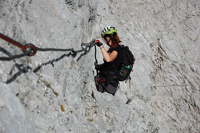
- Overview: This is a challenging route featuring via ferrata (check out our guide here) sections and glacier crossings. It’s ideal for experienced climbers who are comfortable with exposure and using climbing equipment.
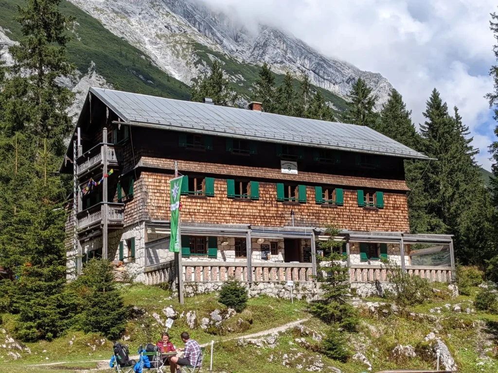
- Water Sources: Refills are available at Höllentalangerhütte. Natural streams in the Höllental Valley can also be utilized, but filtration is recommended.
- Guide Needed? Recommended, especially for first-timers or those without via ferrata and glacier-crossing experience. This route involves crossing the Höllentalferner Glacier and tackling exposed sections with via ferrata equipment.
- The Austrian Route (Moderate to Difficult and not covered here):
- Distance: ~32 km (20 miles) round trip.
- Duration: 12-16 hours round trip.
- Starting Point: Ehrwald, Austria.
- Cable Car Options (Easy, not covered any further here):
- For those not interested in climbing, cable cars from Grainau (Eibsee-Seilbahn) or Ehrwald provide a direct and scenic ascent to the summit.
The Reintal Route (Moderate Difficulty)
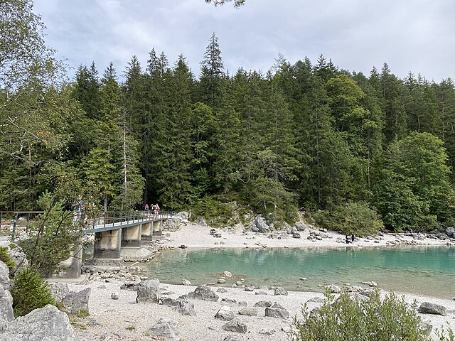
- Start at Partnach Gorge (“Partnachklamm”):
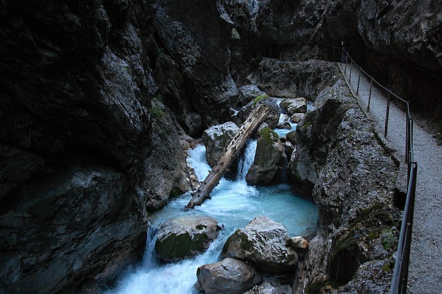
- Begin your journey in Garmisch-Partenkirchen and head to the entrance of the Partnach Gorge. The gorge features wooden walkways, narrow paths, and cascading waterfalls. Follow the marked trail through the gorge (approximately 2 km / 1.2 miles).
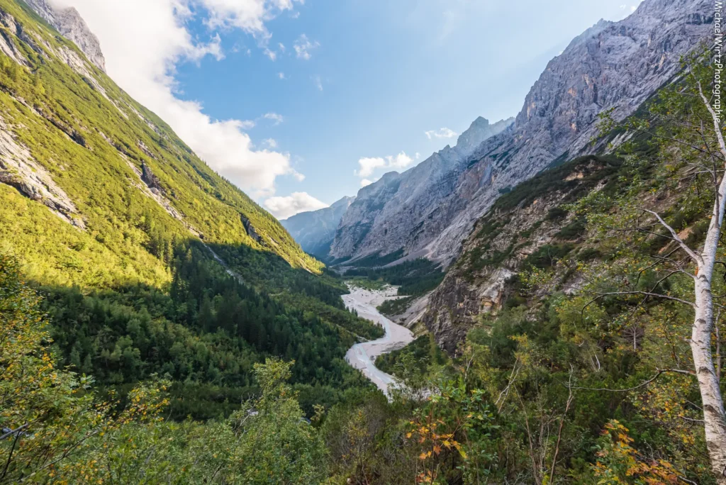
- Continue into the Reintal Valley:
- Exit the gorge and follow the trail along the riverbed into the Reintal Valley. This section is relatively flat and shaded, passing through meadows and dense forests (approximately 6 km / 3.7 miles).
- Reach the Partnachalm:
- Stop for a break at Partnachalm (at approximately 985 meters in height, or 3,232 feet), a small alpine hut offering food and drink. This is a great place to refill water and rest.
- Ascend to Bockhütte:
- Follow the trail as it begins to climb gradually toward Bockhütte (also known as the Reintalangerhütte). The distance from Partnachalm to Bockhütte is approximately 7 km (4.3 miles) and lies at a height of approximately 1,052 meters (3,451 feet). You’ll encounter stunning views of the valley and surrounding peaks.
- Continue to Knorrhütte:
- After resting at Bockhütte, proceed on a steeper trail toward Knorrhütte, located at an altitude of 2,052 meters (6,732 feet). This segment is around 5 km (3.1 miles) and takes 2-3 hours. The trail becomes rockier and more exposed, including grade I scrambling (check out this guide about scrambling).
- Final Ascent to the Summit:
- From Knorrhütte, follow the marked path toward the summit. The trail becomes significantly steeper and more challenging (grade II scrambling), taking 3-4 hours to complete this 5 km (3.1 miles) segment. Use trekking poles for stability.
The Höllental Route (Difficult)
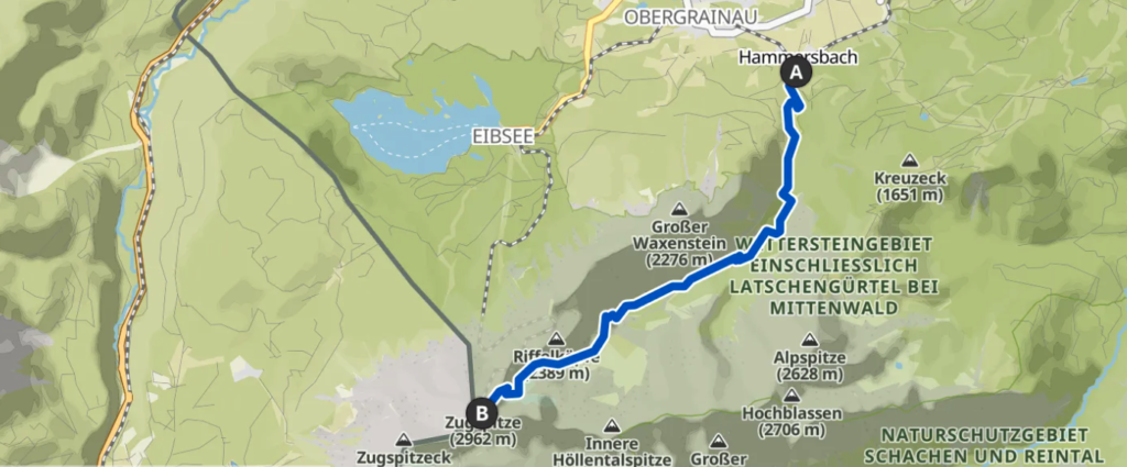
- Start at Hammersbach:
- Begin at the parking area or train station in Hammersbach. Follow the signs for the Höllental Gorge (“Höllentalklamm”). The trailhead is well-marked.
- Enter the Höllental Gorge:
- Pay the small entry fee and navigate through the gorge’s narrow pathways. Marvel at waterfalls and dramatic rock formations. This section is about 3 km (1.9 miles) and takes around 1 hour.
- Ascend to Höllentalangerhütte:
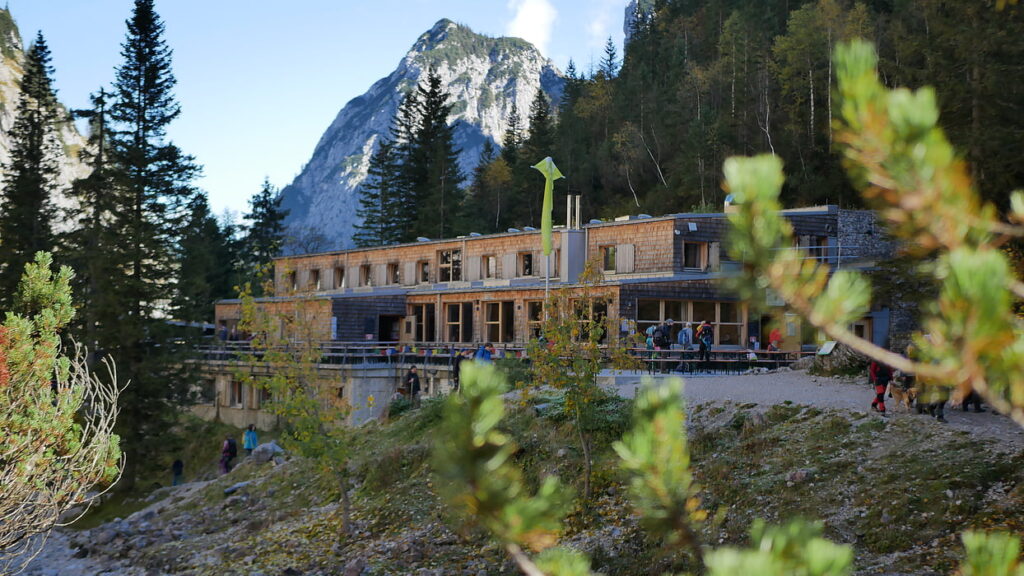
- Exit the gorge and follow the trail uphill to Höllentalangerhütte, a mountain hut located at 1,387 meters (4,550 feet). This segment is about 5 km (3.1 miles) and takes 2-3 hours.
- Glacier Crossing:
- From the hut, continue on the marked trail to the glacier. Equip your crampons and ice axe to safely traverse the glacier (approximately 2 km / 1.2 miles, 1-2 hours). Watch for crevasses and follow the fixed ropes.
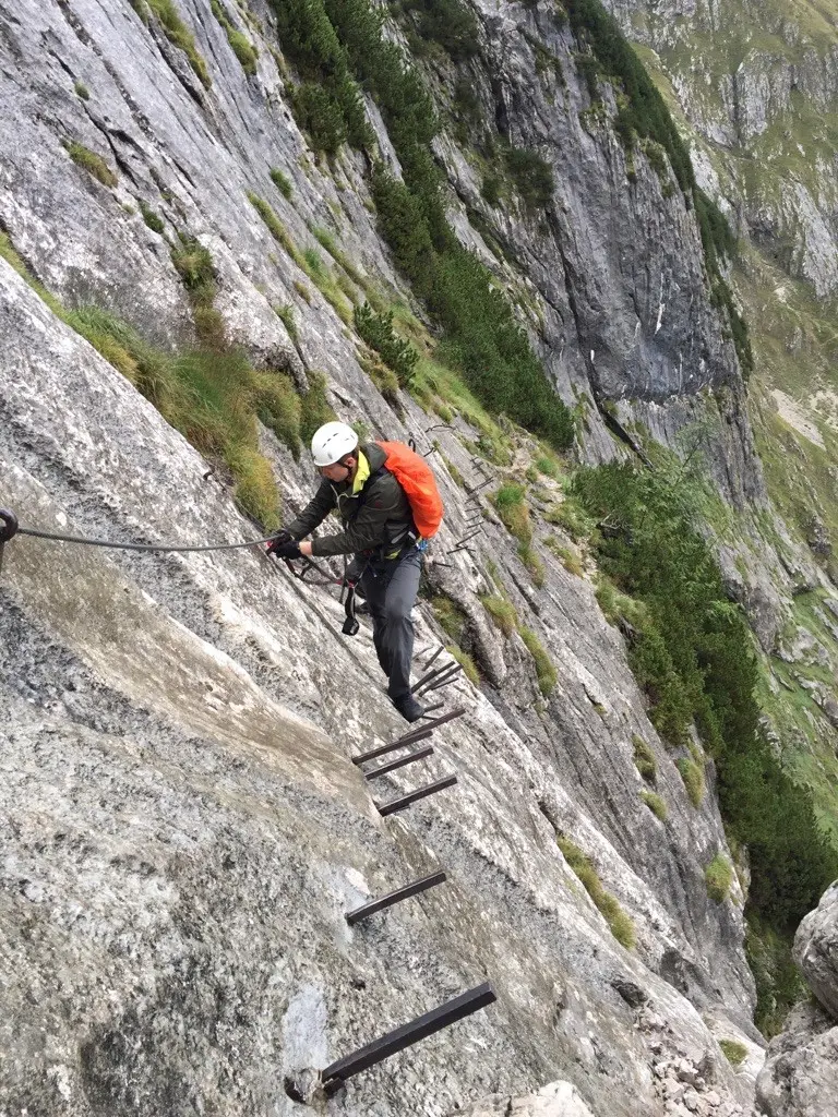
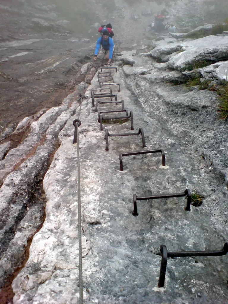
- Via Ferrata Section:
- After crossing the glacier, tackle the via ferrata (difficulty class C: moderate), a section with fixed cables and ladders (grade II-III scrambling). This technical portion takes about 3-4 hours to cover 3 km (1.9 miles). Ensure you use a harness and via ferrata kit.
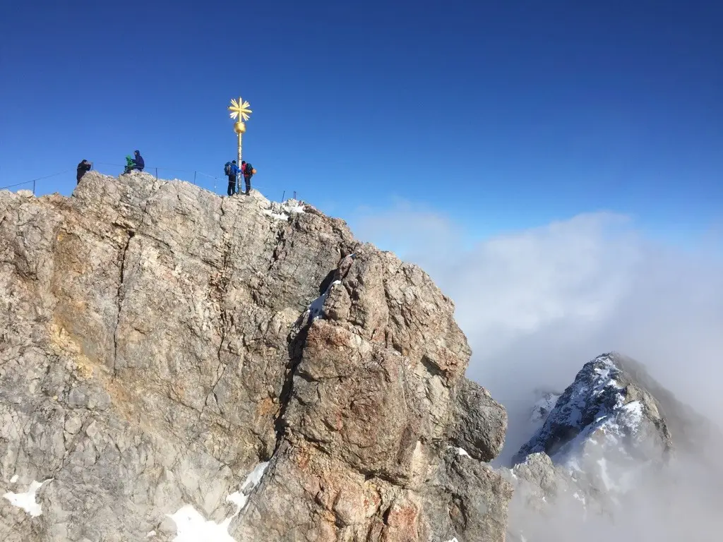
- Final Climb to the Summit:
- Continue on the marked trail to the summit. The final section is steep and exposed but well-marked.
Physical Preparation for the Hike

The Zugspitze can be climbed by most people with a reasonable level of fitness, but the difficulty of the climb depends on the route you choose.
- Endurance Training: Engage in regular cardio exercises such as running, cycling, or swimming to build stamina.
- Strength Training: Focus on leg and core exercises like squats, lunges, and planks to enhance stability and endurance on steep terrain.
- Hiking Practice: Take long hikes with a loaded backpack to simulate climbing conditions.
- Acclimatization: Spend a few days at higher altitudes before attempting the climb to reduce the risk of altitude sickness.
Essential Gear and Preparation
- Climbing Gear:
- Harness and via ferrata kit (for the Höllental Route).
- Crampons and an ice axe (for glacier crossings).
- Trekking poles.
- A sturdy pair of hiking boots.
- Clothing:
- Other Essentials:
- A detailed map or GPS device.
- Plenty of water (at least 2-3 liters) and high-energy snacks.
- A first aid kit.
- Sunscreen and sunglasses.
- Water Filtration Device: Essential for treating water from natural sources.
Accommodation Options
- Mountain Huts:
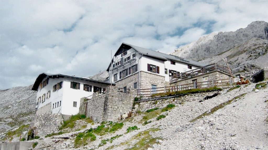
- Knorrhütte: Located along the Reintal Route. Official Website.
- Höllentalangerhütte: Situated on the Höllental Route. Official Website.
- Hotels in Garmisch-Partenkirchen:
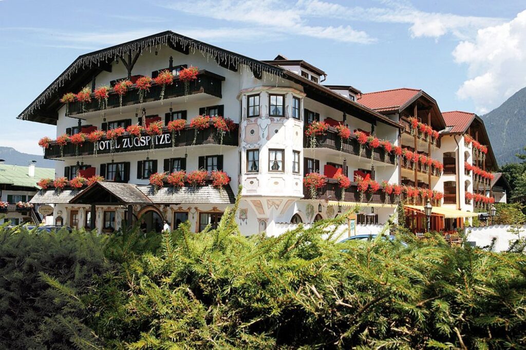
Garmisch-Partenkirchen offers a range of hotels, guesthouses, and hostels for all budgets. Below are some examples:- Hotel Zugspitze: A four-star hotel with a spa and wellness area. Visit Hotel Zugspitze Website.
- Riessersee Hotel Resort: Cozy Bavarian-style rooms by the idyllic Riessersee. Visit Riessersee Hotel Resort Website.
- Hotel Bavaria: An eco-friendly hotel, a short walk from the town center. Visit Hotel Bavaria Website.
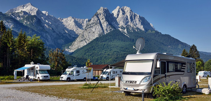
- Camping and Tenting Options:
- Designated Campsites: There are campsites in Grainau and around Garmisch-Partenkirchen, offering amenities like showers and electricity.
- Wild Camping: Not permitted in the area due to environmental regulations. Stick to designated camping spots.
- Mountain Huts with Tenting Areas: Some mountain huts, like Knorrhütte, have areas nearby where tenting may be allowed. Check with the hut in advance for availability.
Safety Tips and Survival Guide
- Preventing Danger:
- Always check the weather forecast before your climb; avoid climbing during thunderstorms or high winds.
- Stick to marked trails and follow local guidelines to avoid getting lost.
- Inform someone of your planned route and expected return time.
- Carry sufficient water and snacks to prevent dehydration and fatigue.
- Wear proper climbing gear and ensure it is in good condition.
- Survival Essentials:
- Pack a thermal blanket and extra layers in case of sudden temperature drops.
- Keep a fully charged phone or a portable charger for emergencies.
- Learn basic first aid to handle minor injuries and recognize signs of altitude sickness.
- Carry a whistle or signal device to attract attention if needed.
- Emergency Contacts:
- German Emergency Number: 112
- Mountain Rescue Service (Bergwacht Bayern): +49 89 140 80
- Local Information Center in Garmisch-Partenkirchen: +49 8821 180 700
- In Case of Emergency:
- Stay calm and assess the situation.
- Use your phone to contact emergency services and provide your exact location.
- If stranded, stay in place and use your thermal blanket to conserve heat
Tips for a Successful Climb
- Acclimatization: Spend a day or two in Garmisch-Partenkirchen or at a mid-altitude mountain hut to acclimatize.
- Start Early: Begin your climb at dawn to ensure ample daylight and avoid afternoon thunderstorms.
- Check the Weather: Conditions in the Alps can change rapidly. Avoid climbing in poor weather.
- Guided Tours: Consider hiring a guide, especially for the Höllental Route.
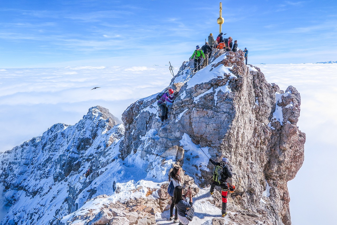
Summit Experience
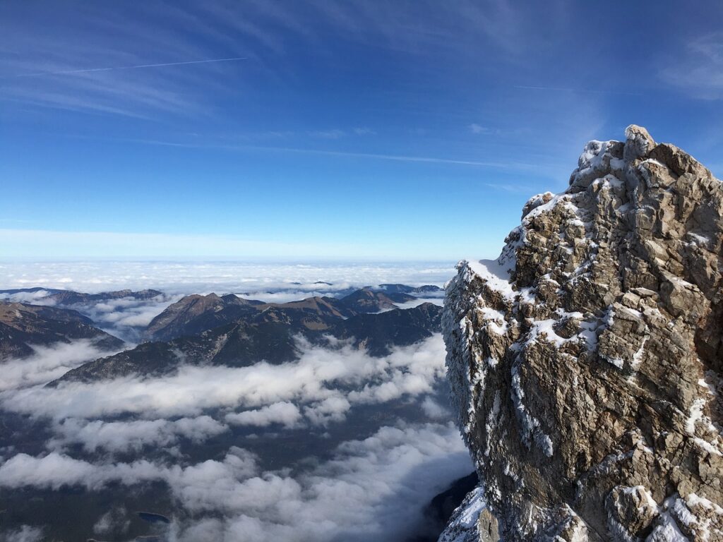
The summit of Zugspitze offers breathtaking views of over 400 peaks spanning Germany, Austria, Switzerland, and Italy. A summit cross marks the highest point, and there’s a visitor platform with a restaurant and weather station. Enjoy the panoramic vistas and celebrate your achievement with a hearty Bavarian meal.
Climbing Zugspitze is an unforgettable adventure, offering breathtaking views, physical challenges, and a deep connection to the Bavarian Alps’ natural beauty. Whether you choose the gentle Reintal Route, the thrilling Höllental Route, or the Austrian ascent, each path provides unique experiences for climbers of varying skill levels.
The journey to Germany’s highest peak requires careful preparation, respect for the environment, and awareness of your abilities. Proper equipment, physical fitness, and attention to safety are essential for a successful climb. Plan your trip during the best weather window, carry sufficient supplies, and always be ready to adapt to changing conditions.
As you stand at the summit, gazing over the Alps and the countries they span, you’ll feel a profound sense of accomplishment. Climbing Zugspitze isn’t just about reaching the top—it’s about the journey, the people you meet, and the memories you create along the way.
With preparation and determination, Zugspitze awaits you as an extraordinary challenge and a deeply rewarding experience. Safe climbing, and enjoy your adventure!